
The architecture, engineering, construction, and operations industry is under constant pressure to move faster, reduce risk, and make better decisions with less room for error. Yet many teams still rely on manual site walks, fragmented field documentation, and inconsistent records to understand what is actually happening in the field.
That gap matters more than ever. When site visibility is incomplete or subjective, teams lose time resolving RFIs, defending decisions, validating progress, and reconciling what was planned with what was built.
As Cathi Hayes, VP Go-to-Market, Hexagon Multivista, explains, “Reliable, objective site context is no longer optional – it is foundational.”
That is the role of Hexagon Multivista Capture services. They provide verifiable reality capture that gives project teams a dependable, third-party record of field conditions without slowing down the jobsite or adding operational burden. Just as the first blog in this series positioned Create services as the bridge from physical reality to usable digital assets, Capture services establish trusted, unbiased site context that supports a range of downstream workflows where reality capture matters most.
Introducing Hexagon Multivista Capture services
Capture services are built for the full range of AECO stakeholders who need trustworthy visibility into site conditions:
- For architects and engineers, it means quick access to visual context that can help resolve questions without repeated site visits.
- For general contractors, it means consistent visibility to manage progress for pay app verification, accountability, and risk.
- For developers, it means independent, unbiased verification.
- For owners, it means objective documentation that helps protect capital investments and reduce disputes.
- For facilities teams, it means a stronger record to support handover and future operations.
Hexagon Multivista delivers that visibility through a coordinated set of Capture services that use photography, UAV / drone services, 3D laser scanning, webcams, and self-captured infill photos to create a dependable record teams can trust across the lifecycle. The goal is not simply to collect images or scans, but to establish an objective, unbiased site context that can stand up when decisions, questions, or disputes arise.
Why Hexagon unified these services
Across the industry, capture data is often collected in isolation. One vendor provides photos, another handles 3D laser scanning, another supports aerial imagery, and the results do not always connect cleanly downstream. Quality varies. Formats vary. The path from capture to modeling or analysis is often unclear.
Hexagon Multivista unified services model is designed to remove that friction. By bringing Capture, Create, Analyze services together under one coordinated organization, Hexagon Multivista makes it easier for customers to start with a specific need and expand only when the project requires it. Instead of stitching together multiple vendors, teams can work with one partner, one delivery framework, and one broader ecosystem.
That matters because capture is most valuable when it does more than document. As Cathi puts it, “Capture is not positioned as a standalone endpoint – it is the foundation for smarter decisions across design, construction, and operations.”
That idea is central to the entire series. Capture creates a trustworthy field context. Create turns that context into models, documentation, and connected digital twin-ready assets. Analyze helps teams measure progress, detect deviations, and act sooner.
What Capture services deliver
Hexagon Multivista Capture services support different workflows, but they all serve the same purpose: helping teams understand the built environment with greater confidence.
Photo Documentation
Photo documentation gives teams indexed visual records tied to floor plan location and date, helping them track progress for schedule and pay app verification, verify installations, resolve disputes, and virtually deconstruct conditions when questions come up later. It is especially useful when teams need an unbiased visual record of work before cover-up, project milestones, or at handover.
For many customers, this is the most immediate way to improve accountability and visibility without changing how the field operates day to day. It creates a dependable baseline of what was installed, when it was visible, and how conditions looked at that specific point in time.
3D Laser Scanning
3D laser scanning brings a higher level of precision when teams need millimeter-accurate point clouds to support as-built modeling, 2D documentation, renovation planning, or downstream deviation analysis. It reduces repeat site visits caused by missed measurements and gives teams stronger physical data when precision matters most.
This service is especially valuable when existing conditions are a major project risk. Instead of relying on incomplete drawings or manual verification, teams can work from accurate captured geometry that supports design, coordination, and long-term documentation needs with much greater confidence.
GoCapture
The GoCapture app extends that visual record by letting teams add self-captured in-fill photos as conditions arise without creating a disconnected workflow. Those photos live on the same cloud platform as the rest of the project record, with the same visual navigation by floor plan and by date.
That flexibility matters on fast-moving projects where teams may need to capture a specific issue, installation, or milestone between scheduled documentation events. GoCapture supports a more complete and connected field record while keeping self-captured documentation accessible in the same place as scheduled project capture.
UAV / Drone services
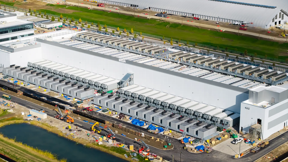
UAV / drone services provide high-resolution aerial imagery, video, and orthomosaic mapping for large or hard-to-reach areas. This adds a different layer of visibility for progress tracking, quality control, and site logistics, especially on projects where ground-based documentation alone does not show the full picture.
For large sites, exterior envelope work, infrastructure interfaces, or broad site coordination, aerial capture helps stakeholders understand progress and site conditions in a way that is difficult to achieve from the ground. It can also support wider reporting workflows when teams need a clearer view of sitewide performance.
Webcams
Webcams add continuous, fixed-position visibility through live views, time-lapse content, and secure hosting that helps keep stakeholders aligned over time. They are especially useful when teams want a persistent visual record of site activity, milestone progression, and overall project movement.
Because webcams create a steady stream of site context, they help reduce ambiguity for stakeholders who are not on site every day. They also provide a simple way to communicate progress to internal teams, owners, and external partners who need visibility without frequent site visits.
Capture as the foundation for expanded value
Customers do not need to adopt everything at once. A team may start with photo documentation to improve accountability. Another may begin with 3D laser scanning because existing conditions are the primary risk. A third may need UAV / drone services for sitewide visibility. The right starting point depends on the problem being solved.
But once trusted capture data exists, the opportunities expand. 360° photo documentation can support progress workflows. 3D laser scanning can feed as-built models or deviation analysis. UAV / drone data can support earthwork progress reporting. Captured site context can become the starting point for the Create and Analyze workflows that depend on reliable reality capture.
As Cathi states, “This flexible approach allows teams to start where they are – and expand only when the project demands it.”
That is an important message for customers who do not want to overcommit on day one. Capture services deliver immediate value on their own while also creating a stronger foundation for broader coordination, modeling, analysis, and lifecycle outcomes over time.
Conclusion
Trusted capture changes the quality of downstream decisions. When teams can see what is actually in place by referencing objective, unbiased documentation and dependable field context, they spend less time arguing about conditions, searching for historical photos, or finger-pointing in the absence of consistent and easily accessible records, and more time moving the project forward. They reduce destructive discovery, improve accountability, and create a stronger foundation for design, construction, handover, and operations.
Hexagon Multivista Capture services are not just about collecting site data. They are about establishing confidence early, so every next step is built on something teams can trust.
Ready to see how Capture services can support your project? Book a free 30-minute consultation with our team to discuss photo documentation, UAV and drone services, webcams, GoCapture app, and 3D laser scanning.