Home  >  Services  >  Analyze >  

Earthwork Progress Reporting

Earthwork Progress Reporting

Geospatial capture and volume calculations that produce accurate cut-and-fill insights.

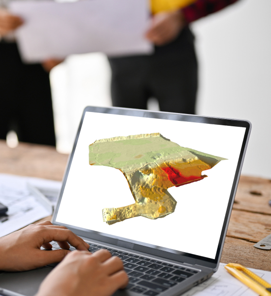
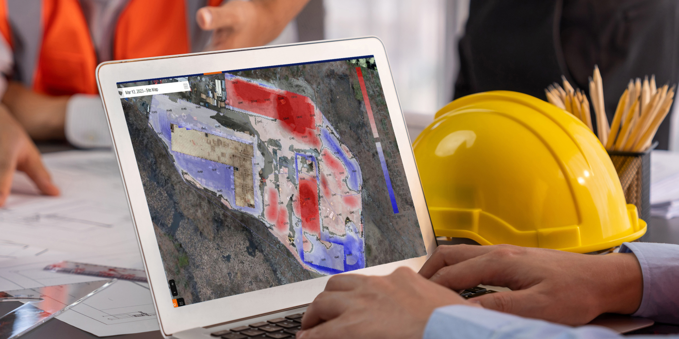
Precise cut & fill volumes, delivered

Using UAV capture and proprietary technology to deliver accurate cut/fill volumes. As-built data is analyzed against project benchmarks, identifying cut/fill discrepancies. Post-flight reports provide change-over-time insights, ensuring efficient project management and transparent communication via the cloud portal.

Benefits

Ensure accurate progress tracking by comparing cut and fill volumes to design plans, so you can confidently plan the next steps.
Ensure confidence in billing and timelines by monitoring precise earthwork volumes from start to finish.
Reduce delays and miscommunication by providing real-time, visual earthwork data accessible anytime, anywhere.

About earthwork progress reporting

UAV-based site capture

High-resolution UAV imagery is processed into orthomosaics and point clouds, creating a reliable as-built surface for accurate volume calculations.

Cut & fill volume analysis

Automated comparisons measure differences between design intent, existing terrain, and current surfaces to identify variances across the site.

Change-over-time reporting

Compare multiple flights to understand progress trends, confirm work completed, and monitor schedule alignment.

Colorized visual overlays

Cut and fill conditions are displayed through intuitive color-coded maps that make grading adjustments easy to interpret and communicate.

Region-specific reporting

Define specifics areas to track volumes independently, enabling targeted reviews of staging zones, pads, or sequencing areas.

Multi-format deliverables

Receive project specific reporting with quantities and trends, distributed on your platform of choice or via email.

How it works

Capture & upload

Provide project plans, control points and base files. UAV capture of project site leads to accurate surface generation and comparisons.

Data processing & comparison

We convert imagery into orthomosaics and point clouds, then compare them to design surfaces to identify cut/fill variances.

Progressive updates

Recurring UAV flights capture grading progress at the cadence you choose, offering continuous visibility throughout construction.

Volume analysis

Advanced algorithms measure cut and fill quantities and surface deviations to validate progress and detect discrepancies early.

Visual & trend reporting

Colorized overlays and Excel trend charts provide intuitive insights into earthwork progress and site grading performance.

Cloud delivery

All reports and models are delivered through the Hexagon MDS portal for secure, centralized access.

Industries

Industries we support and more

Testimonials

Discover success stories from our clients

FAQs

It is an integrated system that combines UAV photo capture, AGTEK technology, and the MDS cloud portal to generate 2D/3D volumetric and spatial datasets.
The solution compares as-built data from drone flights against the design intent or established grade to identify cut/fill volume discrepancies across the site.
Users receive detailed reports , high-resolution cut/fill map overlays , and change-over-time charts to track trends and quantities.
The solution provides Insight into remaining work by comparing site progress to plans , Confidence through accurate volume tracking for scheduling and payment verification , and Transparency via 24/7 cloud-based access to visual and analytical reports.

Talk to our team

Get a custom review of your project needs and learn how earthwork progress reporting can improve accuracy, visibility, and schedule alignment.

Talk to our team

Get a custom review of your project needs and learn how earthwork progress reporting can improve accuracy, visibility, and schedule alignment.